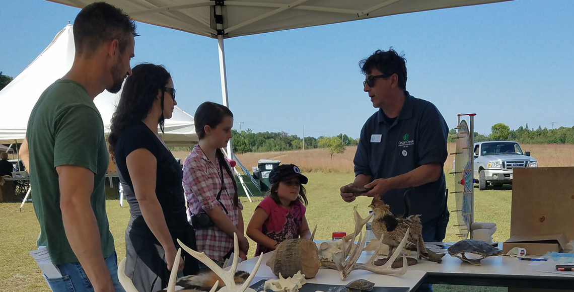
Map and directions

Directions

Navigate using Google MapsYou can also type 'Fish Lake Nature Trail' into your own Google Maps search bar. Make sure to select the one on Durant St. The parking lot is ONLY accessible by heading north up Durant St rather than coming in from the north and east.

From Highway 65, turn east at Cooper’s Corner onto 237th Avenue. Take this road until it ends at a T-junction, where you will see a sign for Cedar Creek. Take a right at the T onto Gopher Drive. Follow the road around the curve to the left as the road changes names to 229th Avenue.  Stay on 229th and take a left onto Durant Street (look for the brown park sign with 'Fish Lake Nature Trail' written on it). Go up Durant Street and turn right onto the dirt road at the end which leads to the parking area, kiosk, portable restroom and trailhead. 

From Highway 35, Take exit 135 for US-61 S/Chisago County 22 toward Wyoming. Turn left onto US-61 N/E Viking Blvd. Turn right onto Typo Creek Dr NE. Turn left onto 227th Ave NE. Continue onto 229th Ave NE. After 2.3 miles, turn right on Durant St. (look for the brown park sign with 'Fish Lake Nature Trail' written on it). Go up Durant Street and turn right onto the dirt road at the end which leads to the parking area, kiosk, portable restroom and trailhead. 

About the trail

Facilities include a pavilion with picnic tables, dirt parking area, information kiosk, benches, trash receptacles, and porta-potties. There is no running water at the trailhead or along the trail.

The Fish Lake Nature Trail, also known as the John A. Harstaad Interpretive Trail, is dedicated to the memory of Cedar Creek scientist and naturalist John Harstaad. This trail winds through several distinct ecosystems along its 1.5 mile (one way) path. Hikers first pass through a sand prairie on the way from the parking lot to the lake. Turning left at the lake leads through a bur oak savanna where red-headed woodpeckers nest and feed. Continuing around the south end of the lake, there is a cattail wetland on the left and the lake on the right. Sandhill cranes and water birds are commonly visible in this section. Traveling on to the southwest corner, one comes to the beginning of a deciduous forest and then to the first of four boardwalks crossing the cattail marshes. The trail ends in the forest and the return journey features the parade of ecosystems in reverse.

Special thanks to the City of East Bethel, friends and supporters of Cedar Creek, and the Legislative-Citizen Commission on Minnesota Resources for providing funding for this project.

Year-round activities
  • Birding — The Fish Lake Nature Trail provides ample opportunities for birders of all levels to see something interesting! More than 190 species have been documented from the trails over the last few years, thanks to the variety of habitats the trail passes through. You can track (and contribute!) recent sightings on our eBird hotspot.
  • Geocaching — Five geocaches are placed along the trail. Bring your own GPS and see if you can locate them! For coordinates, visit the official geocaching website "Geocaching" or download this brochure from the City of East Bethel listing the codes for the five Fish Lake caches as well as several others around the city.
  • Reporting on iNaturalist — Are you an iNaturalist user? These habitats are home to a diverse assemblage of plants and animals. Any observations you upload from the trail will automatically be added to the project! Check out some of what you might see on our iNaturalist project, Biodiversity of Cedar Creek.
Rules and regulations
  • Day use only (sunrise to sunset)
  • Park only in designated areas (please do not park along Durant St.)
  • Deposit all trash in available receptacles.
  • No fires allowed and no smoking on trails
  • Stay on designated trails
  • No motorized vehicles, including ATV’s, dirt bikes, and snowmobiles
  • No bicycles
  • No dogs
  • No firearms, hunting, or collecting
  • No alcohol
  • No motorboats on lake (canoes allowed)

Please note: These trails are interpretive and/or nature trails. Please treat them as such, respecting the research and wildlife in the area.

Seasonal activities

Bison trail 

The Oak Savanna Extension Trail is now closed. This 1-mile (one way) trail extension heading south from Fish Lake is open to the public daily in the summer from 8 a.m. - 4:30 p.m. It leads, via sand roads, to the bison viewing gazebo which is staffed by trained interpretive naturalists on the weekends. Because the bison herd roams across 200+ acres of savanna, there is no guarantee that they will be visible from the gazebo. However, you are invited to pop by for a look and an opportunity to learn more about the research! During the week, enjoy a self-guided hike, read interpretive signs, and pick up a brochure to learn more. On the weekends, naturalist volunteers will be on hand with fur, bones, a bison skull and lots of information about the species and the project. The gazebo is also a wonderful place to birdwatch.

Boating on Fish Lake

Non-motorized boats are welcome on Fish Lake. Launch from the east side of the lake, at the end of the path from the parking lot, or at the north side of the lake along Fawn Lake Drive near the intersection with Durant St. (unimproved launch site). Please be respectful of wildlife when using the lake.

Cross-country skiing

When the ground is snow covered, we invite you to snowshoe or cross-country ski the Savanna Loop Ski Trail, a 2-mile loop along internal sand roads. These trails are open to public access only in the winter; during the rest of the year they are used for research and are therefore closed to hikers unless otherwise marked. The trail may or may not be groomed depending on staff availability.